


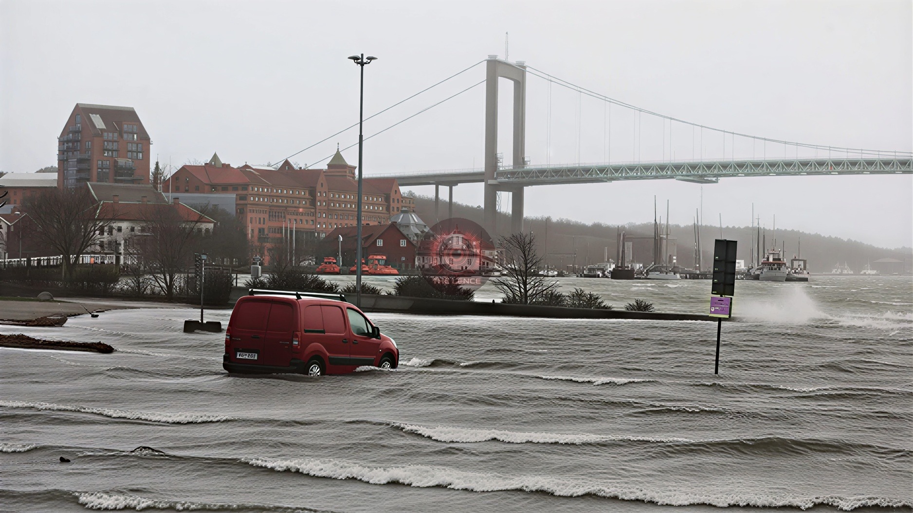
Storm Dave Hits Sweden with Hurricane-Force Winds.
Storm Dave has made a significant impact on Sweden's west coast, bringing hurricane-force winds exceeding 34 meters per second. These powerful gusts have led to widespread disruptions and safety concerns across the region. The Swedish Meteorological and Hydrological Institute (SMHI) has reported gusts reaching up to 36–38 meters per second at coastal stations, while central Gothenburg experiences storm-force gusts of up to 29 meters per second.
Impact on the Region
Fallen Trees and Power Outages.
The storm's ferocity has resulted in trees being blown down in several locations throughout southern Sweden. Emergency services in Greater Gothenburg, led by Mikael Lindgren, are dealing with multiple incidents, including a boat overturned at Packhuskajen. Approximately 30,000 customers from Ellevio, Vattenfall, and Eon suffered power outages starting at 8 p.m.
Transportation Disruptions.
Transportation has been severely disrupted:
- Road Traffic: The Älvsborgsbron bridge in Gothenburg is closed in both directions due to the strong winds, with no clear timeline for reopening.
- Boat and Tram Services: Boat traffic on the river is suspended until further notice. Trams are unable to cross Hisingsbron due to a collapsed contact line.
- Bus and Train Services: Bus services between Borås and Gothenburg are operating with reduced capacity, avoiding double-decker buses. SJ has cancelled numerous train departures, affecting routes to and from major cities like Stockholm, Gothenburg, Malmö, and others until late Monday evening.
Warnings and Precautions.
Weather Warnings.
SMHI has issued an orange warning, the second highest alert level, for northwestern Götaland and northern Halland, effective until 2 a.m. Monday. Cities such as Gothenburg, Trollhättan, Uddevalla, Borås, and Jönköping are expected to endure the strongest winds, although the storm's trajectory is more southerly than originally anticipated.
The storm is expected to peak in intensity on the west coast during the evening. A broader yellow warning covers an extensive area, reaching across Södermanland and down into Småland.
Emergency Measures.
The Swedish Transport Administration has heightened its alert level to rapidly address the challenges posed by the storm. Numerous smaller routes in the affected regions will remain closed until 5 a.m. Tuesday to ensure public safety.
Safety Recommendations
Meteorologist Magnus Nilsson Sangrud advises residents to secure loose objects, such as trampolines, to prevent them from being swept away by the wind. The public is urged to stay informed through official channels and exercise caution, particularly when traveling or spending time outdoors during the storm.




Comments (0)
No comments yet. Be the first!
Leave a Comment